
Dundee North Secondary Plan: Subwatershed, Transportation and Land Use Study
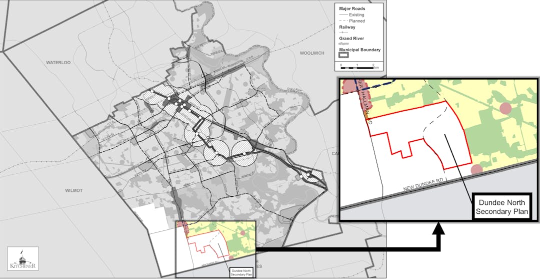
Study Area (red outline): is approximately 241.4 hectares (596.6 acres) in size and is bounded by the limits of the Huron South Plan of Subdivision to the north, the Urban Area Boundary to the south, Fischer Hallman Road to the west and Reidel Road to the east.
We are planning a new community in Kitchener and we need your help!
The purpose of the Dundee North Secondary Plan is to create a detailed planning framework to guide the development of this new community. Learn more about this planning process by reviewing our process map.
As outlined in our Official Plan we are committed to creating a complete and healthy community through:
- the promotion of a compact urban form
- efficient and effective delivery of services
- employment opportunities
- environmental conservation
- the provision of arts and culture, and
- the protection and promotion of cultural diversity.
Right now, these are agricultural lands and some environmentally protected areas. We expect to develop new urban uses such as homes, parks, open space, commercial and schools. This will follow our Official Plan and other regulatory frameworks.
Learn more about this project by reading our Frequently Asked Questions (FAQs).
How can you help?
As part of this project, First Nations, landowners and residents will have opportunities to engage with us. We want to hear from you!
Share your ideas on the Ideas Board or ask us questions using the Ask a Question tab below.
Use the "Subscribe" button to get email updates.

Who's Listening
-

Phone 519-741-2200 x7068 Email dundeenorth@kitchener.ca -

Phone 519-741-2200 x7110 Email dundeenorth@kitchener.ca -

Phone 519-741-2200 x7611 Email dundeenorth@kitchener.ca -

Phone 519-579-3500 x73241 Email DundeeNSecondaryPlan@jacobs.com