
Cycling Network Improvements and Expansion
Study Overview
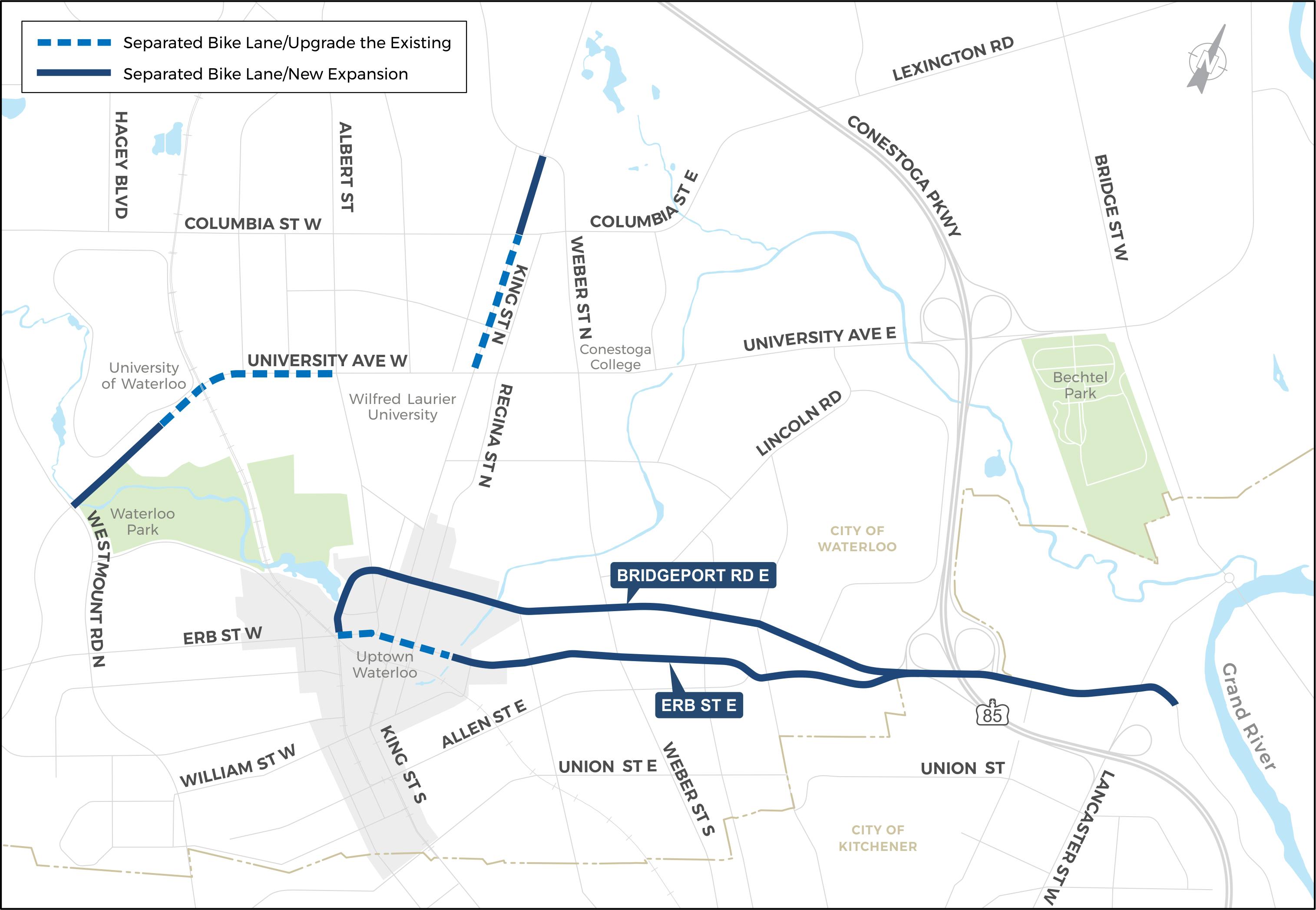
Region of Waterloo Cycling Network Upgrade and Expansion Study
We are looking to convert the temporary cycling facilities introduced through a pilot project in 2019 to permanent facilities and further expand the cycling network. At this time, the Region is only at the design phase — what kind of cycling facility should be used, what could it look like, how would it function.
Cycling network public meeting presentation and final design survey – *Survey closed December 5, 2023*
Thank you to those who have provided feedback on the preferred alternative design. A recording of the public meeting held on November 16 2023, is now available to view. Please complete the online survey by 11:59pm December 5, 2023, to share your comments on the final design.
Final Design Survey (open to December 5 2023)
The project team is collecting any feedback on the preferred alternative before taking the final designs to Regional Council in the Winter of 2024. This feedback period will be open until 11:59pm December 5, 2023. This can be done via the 'Final Design Survey'.
Additionally, comments can be made on the design drawings here: https://miro.com/app/board/uXjVMOzNq2g=/
Virtual Meeting #2 – November 16, 2023
Presentation of Preferred Design Alternatives
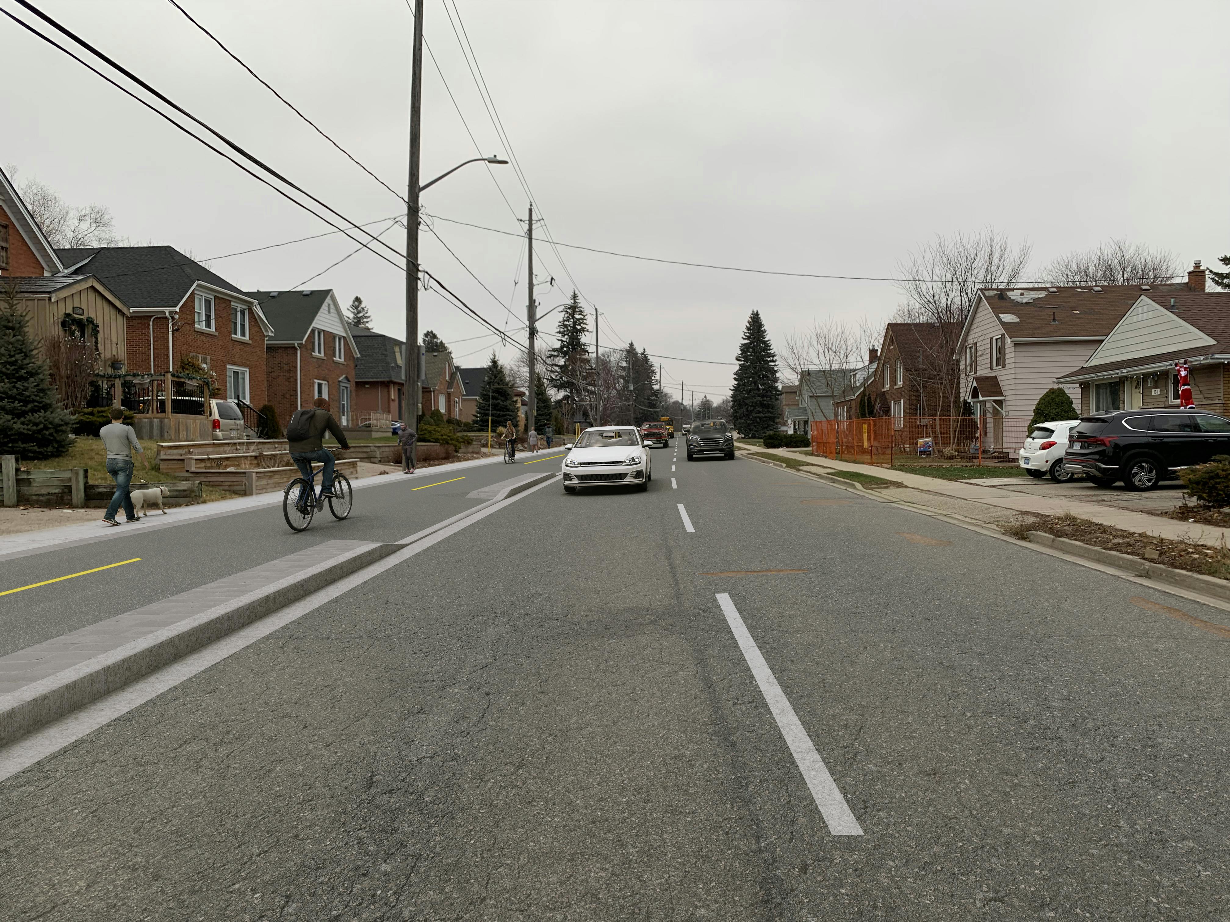
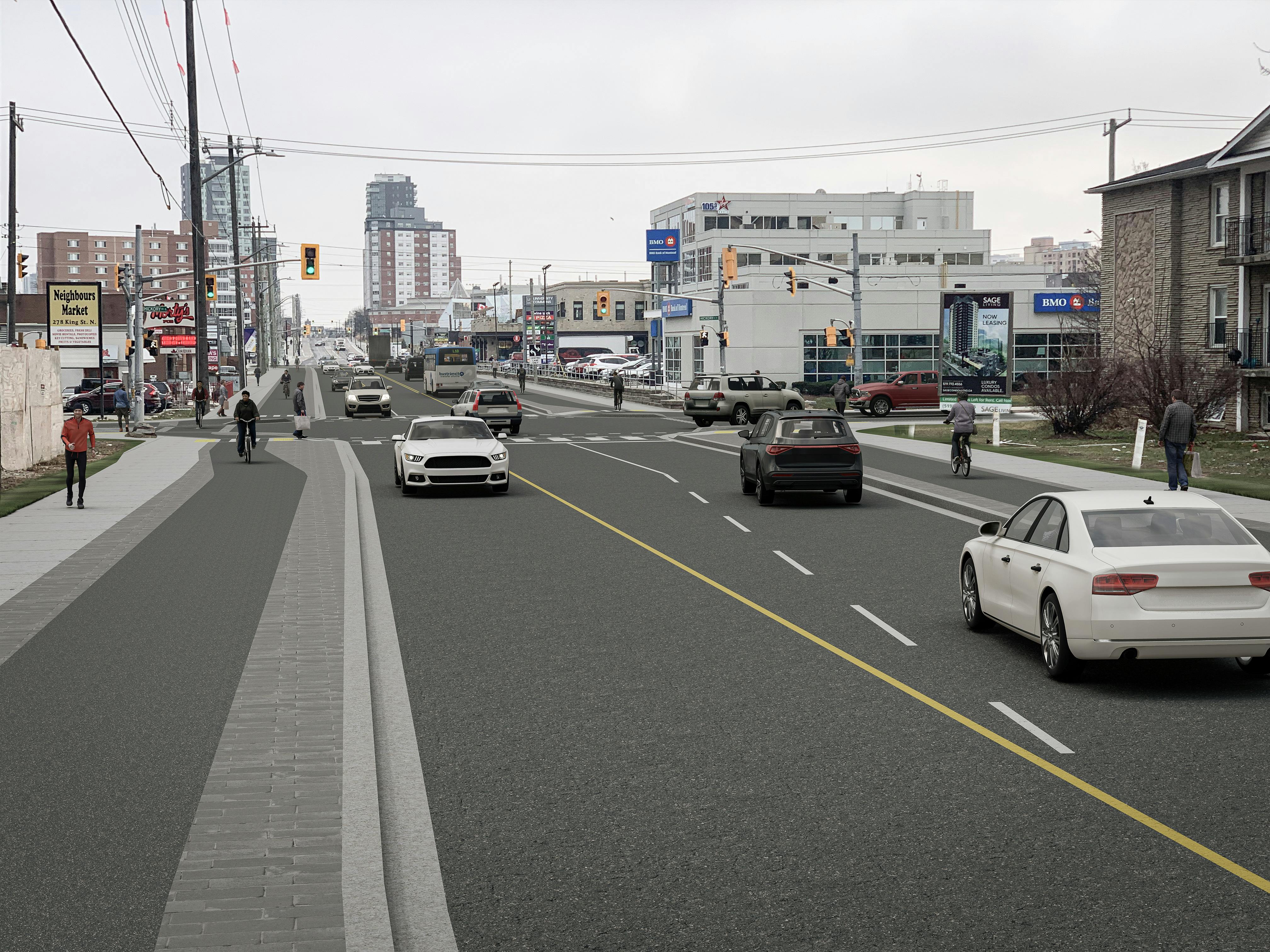
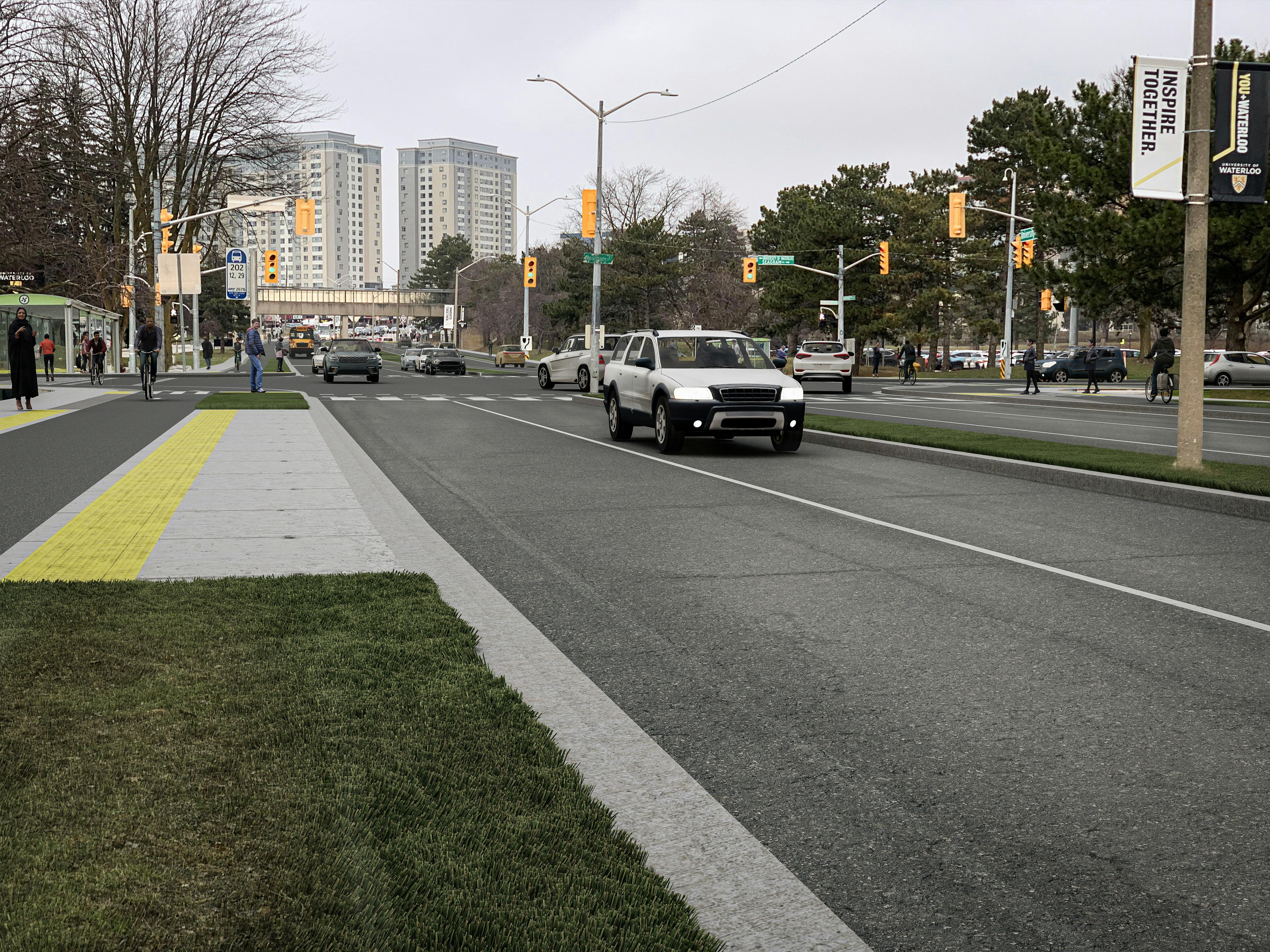
Throughout this study, the Region has evaluated options for both the design of permanent installations to replace the temporary separated facilities and the expansion of the Region’s cycling network to create new connections and close some of the gaps in the local and regional active transportation networks. The preferred design alternatives have been finalized and were presented at a second virtual meeting on November 16, 2023.
During this meeting, the project team:
- Outlined the project, including a summary of work completed to date.
- Explained the process for developing design options for separated cycling facilities along the study area corridors, including an exploration of the evaluation criteria and feedback that led to the selection of the preferred alternative.
- Showed residents what the corridors may look like in the future through visualization tools, renderings and design drawings.
- Provided an opportunity for members of the public to share comments about specific details of the preferred alternative design using an online tool and ask questions of the project team.
A recording of the presentation portion of the meeting and PDF versions of all presentation materials can be found on this page.
The project team is collecting any feedback on the preferred alternative before taking the final designs to Regional Council in the Winter of 2024. This feedback period will be open until November 24, 2023. This can be done via the 'Final Design Survey'.
Want to catch up on what has been done so far? Check out the recording of the previous meeting for this project below.
Virtual meeting #1 — Recorded on September 14, 2022
On September 14, The Region of Waterloo held a Public Consultation Centre about the cycling network expansion. During the meeting, the project team:
- Introduced themselves and provided an overview of the project.
- Explained the process for developing design options for separated cycling facilities along the study area corridors (listed here).
- Outlined design options for separated cycling facilities along the study area corridors.
- Provided an opportunity for members of the public to share their ideas.
The session was recorded, and you can view the recording here (External link), or by clicking the 'Videos" link on the right hand side of this page. You can also review the presentation materials here.
We would like to thank everyone that submitted feedback about the various design alternatives through the comment form. The comment form was open until November 14, 2022.
If you would like to receive further reminders about this project, please subscribe to this webpage using the subscribe button on the right toolbar. We look forward to connecting with you soon!
Ask a question
Be sure to review the Frequently Asked Questions (FAQ) section of this page before submitting a question - it may have already been answered!
Welcome to the Q&A tool! With this tool, you can:
- Ask a question directly to the Project Team
Here's how the tool works:
- Ask your question in the box below and click "Submit"
- Submitted questions are reviewed by The Project Team
- Responses are provided within 5 business days of receipt.
- Sometimes answers require information from multiple sources. If the answer is going to take longer than 5 business days, we will let you know.
Photos

Videos
-
 Separated cycling network public meeting presentation.
-
