
170 Columbia St West (OPA67 & Z-25-14) and 180 Columbia St W (OPA68 & Z-25-15)
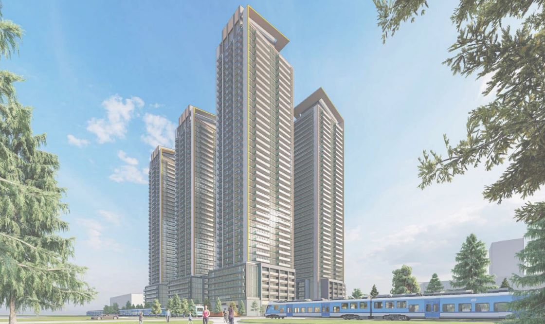
The image shows a 3D rendering of the proposed development facing north along Laurel Trail from the University of Waterloo campus.
Changes to the Official Plan and the Zoning Bylaw for this location are required before a permit can be issued. This means that they submit an application that is reviewed by city planners and other agencies plus city council before anything can be built.
The 170 Columbia St W
lands consist of Phases 1 and 2, while the 180 Columbia St W lands consist of Phase 3, 4 and 5.
On behalf of the applicant, Up Consulting has made a second submission for this project with changes to the design that impacts tower height and location, number of bedrooms and available parking.
Summary of changes
A summary of the changes between submission 1 and submission 2 provide by the consult can be reviewed in the Comment Matrix document (PDF) under the Documents are of this web page and in the tables below.
Building height, units, housing types
Submission 1 | Submission 2 | |
Tallest tower | 41 storeys | 35 storeys |
Number of dwelling units | 2,438 | 1,968 |
Number of bedrooms | 3,206 | 2,993 |
Unit size | Bachelor, 1-bedroom and 2-bedroom | Bachelor, 1-bedroom, 2-bedroom, and 3-bedroom |
Non-residential floor space
Submission 1 | Submission 2 | |
Non-residential floor space (metres squared) | 1,532 | 1,248 |
Parking
Submission 1 | Submission 2 | |
Vehicle parking | 587 | 425 |
Bicycle parking spaces | 1,605 | 1,234 |
View the documents submitted by the development company under supporting documents on this page for more details and drawings.
You can provide feedback to the planning department, and it will be shared with the council, or ask a question to learn more about this application.
Images are provided by the applicant and may not reflect the final design approved by the planning division.
Submission details
The applicant is proposing to a multi-phase mixed-use development that consists of 5 high-rise mixed-use towers ranging from 25 to 35 storeys, along with ground flood commercial/retail spaces and amenity space.
Approval of the Official Plan Amendment 58, means that the lands are now designated Station Mixed-Use and this amendment is not required as a part of this proposal.
Revised Official plan changes requested include:
- create Special Provision Areas to allow for an increased height of the buildings and changes to non-residential floor space
- permit a maximum building height of 35 storeys for Phase 1 and 30 storeys for phase 2
- permit a maximum building height of 35 storeys for phase 3, 25 storeys for phase 4 and 30 storeys for phase 4
- reduce the minimum non-residential floor space required to 0.5 sqm per dwelling unit for phases 3 to 5
Zoning bylaw changes requested include:
- rezone the lands to Holding - Residential Mixed Use with site specific provisions
- permit a maximum building height of 130 m or 35 storeys
- permit a minimum building floor area for non-residential uses of 0.5 sqm per dwelling unit (180 Columbia St W)
- permit a maximum density of 1,460 bedrooms per hectare (170 Columbia St W)
- permit a maximum density of 2,327 bedrooms per hectare (180 Columbia St W)
- permit a maximum podium height of 22.5 m and 7 storeys (170 and 180 Columbia St W)
- permit a minimum tower separation of 7.4 m from the west interior lot line (170 Columbia St W)
- permit a minimum tower separation of 4.4 m from the east interior lot line (180 Columbia St W)
- permit a minimum street line setback of 0.8 m (180 Columbia St W)
- permit a maximum street line setback of 76% of the façade instead of 75% (180 Columbia St W)
- permit a minimum side yard setback of 1.2 m instead of 3.0 m (180 Columbia St W)
- permit a minimum setback of 9.0 m of a railway right-of-way (180 Columba St W)
- permit a maximum 26% (170 Columbia St W) and 32% (180 Columbia St W) of the amenity space as outdoor rooftop amenity space located more than 22 m above grade instead of 20%
- holding provision be applied to the lands relating to a record of site condition and an aeronautical assessment
- all other relief identified throughout the process
The applicant is proposing to a multi-phase mixed-use development that consists of 5 high-rise mixed-use towers ranging from 37 to 41 storeys, along with ground flood commercial/retail spaces and amenity space.
Official plan changes requested include:
- designating the lands from "Employment" to "Station Area Mixed-Use"
- remove "Business Employment" designation on subject property on Schedule A2
- designate the lands from "High Density Employment, 81 metres" to "High Rise, 30 storeys"
- permit a maximum building height of 41 storeys
Zoning bylaw changes requested include:
- rezone the lands to Holding - Residential Mixed Use with site specific provisions
- permit a maximum building height of 130m, 41 storeys
- permit a maximum density of 1,613 bedrooms per hectare (170 Columbia St W)
- permit a maximum density of 2,436 bedrooms per hectare (180 Columbia St W)
- permit a maximum podium height of 22.5 metres and 7 storeys
- permit a minimum tower separation of 7.5 metres from the west interior lot line (170 Columbia St W)
- permit a minimum tower separation of 9 metres from the east interior lot line (170 Columbia St W)
- permit a minimum tower separation of 6.7 metres from the east interior lot line (180 Columbia St W)
- permit a maximum streetline setback of 11.2 metres (170 Columbia St W)
- permit a maximum streetline setback of 11.8 metres (180 Columbia St W)
- permit a minimum landscape open space of 21% (180 Columbia St W)
- holding provision be applied to the lands relating to a record of site condition and an aeronautical assessment
- all other relief identified throughout the process
View the documents submitted by the development company under supporting documents on this page for more details and drawings.
You can provide feedback to the planning department, and it will be shared with the council, or ask a question to learn more about this application.
Images are provided by the applicant and may not reflect the final design approved by the planning division.
Give feedback
Ask a question, read answers
Questions and answers will be published on this site for public viewing. If your username includes your first or last name, or your email address, these will be available for public viewing. Do not include personal or identifying information in your question; if your question is of a personal nature, consider contacting a member of the project team directly. For more information, please refer to our privacy policy.
Questions will be answered by a member of the Planning department within two business days. Some questions may require more time but they will be answered as soon as the information for the response can be collected.
Submit a question and the assigned project lead will be notified.
To ask a question you must create an account or log in.
These are the people that are listening and responding to your questions.
Natalie the planner
Planner
{{question.description}}


