
Laurelwood Multi-use Path
Consultation has concluded
Thank you to all who provided feedback, this project is now complete.
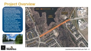
Welcome to this project page for the Laurelwood Drive multi-use path. The project area extends approximately 675m along the section of Laurelwood Drive between the Doreen Thomas Trail and Beaver Creek Road.
The primary objective is to develop a design for a multi-use path that will form part of the ultimate trail route around the perimeter of Laurel Creek Conservation Area. The proposed multi-use path will provide an all ages and abilities cycling connection through the project area with consideration for user comfort and safety, in addition minimize impact to existing infrastructure and the GRCA wetland and Laurel Creek Conservation Area.
Three different options were considered, with the chosen option selected for having the best balance in limiting impact to GRCA lands while maximizing function. This design option includes the following:
- three meter asphalt multi-use path
- a one meter wide boulevard street buffer
- existing east bound bike lane maintained (west bound bike lane removed)
- a two meter raised median located just west of Laurel Gate Drive to provide an opportunity for people to cross the street mid-block
More detailed information is now available in the Laurelwood Multi-use Path Construction Information document.
Comments
Consultation has concludedCLOSED: This discussion has concluded, thank you for participating.
Project Library

Presentation
Who's Listening
-
-
TM
-


This is well overdue! We regularly cycle and the stretch of Laurelwood Dr from Beaver Creek Road to Fischer Hallman is dangerous and difficult. Now, if only you could create proper bike lanes on Fischer Hallman from Laurelwood to Columbia.
Bike lanes again! I hope there is a study that proves people will actually use them. On Westmount Road, the bike lanes between Columbia and Weber are seldom used. I do favour a multi-use path as long as it is used and it does not take away from any lanes used by vehicles. In addition, is this a necessary path. Most automotive manufacturers are going to electric based vehicle and self driving vehicles. So, do we need to concentrate on charging stations and preparing for this mode of transportation?
Here we go again! Bike lanes. How many people will actually use them? I do not feel safe walking on a trail with bikes wizzing by you. What damage are you going to do to the environment and Laurel Creek Conservation area. As a person who has property governed by conservation area, I am surprised that the Conservation authority will actually allow you do this. The hoops we had to jump through to replace a shed that was deemed on our property for 60 plus years was in violation of the new grand river conservation authority. As long as it does not take away lane space and congest traffic, you can build it, but please do not waste money if no-one uses it.
We at the AvonTrail( a 45 yr old hiking trail from St Mary's to Conestogo) are very happy with this proposed multi use path because it incorporates part of the Avon Trail reroute proposed by us to the City of Waterloo, through N-W Waterloo.
I regularly cycle around Laurel Creek as part of a regular recreational route out of Uptown Waterloo. I welcome this safer and more comfortable addition to our trail system in the City of Waterloo and the Region of Waterloo Region.
I hope that all both levels of government in our region will continue to improve and enhance the opportunities for cycling and walking with in a safe environment. Connecting existing routes to one another are a high priority for me and my friends.
As a Resident and Tax Payer in the Region for over 45 years, I am pleased to see active Transportation choices within our region beginning to improve. For too long I watched my Taxes go to support transportation choices that only encouraged more cars while making walking and cycling more difficult.
I am very happy toes some improvement.